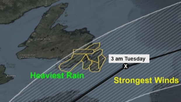
An expert says the centre of Hurricane Ernesto could avoid making landfall off Newfoundland, but he is still keeping an eye on the heaviest rain and winds heading into the weekend.
The latest track of the storm now passing over Bermuda is expected to pick up speed in colder water before making its way over eastern Newfoundland on Monday night into Tuesday.
“The official forecast right now is for the centre to stay offshore, but there’s still a possibility of landfall in eastern Newfoundland and Labrador, the island portion at least,” Bob Robichaud, a warning preparedness meteorologist with the Canadian Hurricane Centre, told reporters Friday.
“What we expect the storm to look like by the time it passes there is that the heaviest rain is going to be on the left side of the track, and that the strongest winds are going to be on the right-hand side,” he said.
:So even if the storm does actually make landfall in say the eastern part of the Avalon Peninsula, the strongest winds are still expected to be offshore.”
But while the heaviest winds could stay off of the Avalon, Robichaud said high waves caused by those winds could present problems.
Waves could reach between five and 10 metres in peak height overnight in open areas of the coast and east of the Burin Peninsula. There’s also a risk of storm surge, damage to wharfs and other structures, and possible coastal erosion.
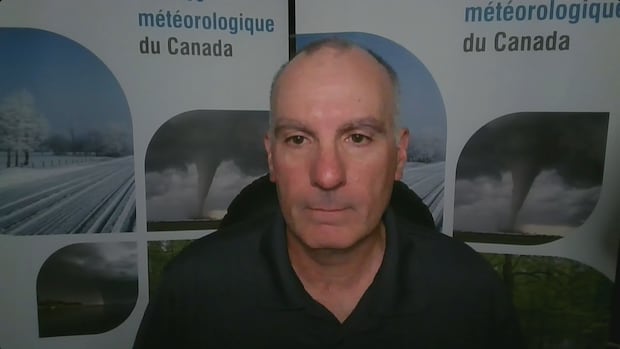
Meteorologists are keeping an eye on Hurricane Ernesto as it moves north from Bermuda and toward the Atlantic provinces. The storm is expected to then track east early next week and possibly make landfall over the Avalon Peninsula. Warning preparedness meteorologist Bob Robichaud held a virtual news conference on Friday to explain.
Robichaud stressed the importance of monitoring forecasts over the weekend to see how the storm track changes or develops.
“If it stays where it is now, we expect the really stronger winds, any kind of damaging ones, to stay offshore,” he said.
“It’s going to be so important to monitor the progress of the system over the weekend, to make sure that track doesn’t start to edge a bit further toward the west.”
Download our free CBC News app to sign up for push alerts for CBC Newfoundland and Labrador. Click here to visit our landing page.


