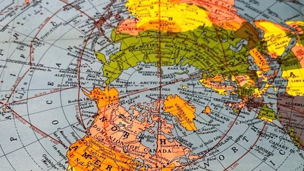
A road map in the glove compartment of your car. A travel map in your backpack. A world map on your wall, with pins poked in the countries you’ve visited.
For older generations, maps are more than just pieces of paper — they’re symbols of where we’ve been and where we might go. But as GPS and cell phones take over, is map-reading becoming a lost skill? In January, The Guardian reported that three-quarters of UK adults have trouble reading a map; and in 2019, even one of the inventors of the GPS navigating system lamented there was a drawback to his advancement.
“The fact is that people don’t know how to read maps anymore. I love maps,” said Professor Bradford Parkinson, according to Yahoo News.
It’s a concern shared by Brad Green, who, along with his partner Petra Thoms, owns the shop World of Maps in Ottawa.
Green estimates that the shop, which has run a successful business since 1994, has thousands of maps in stock, and tens of thousands more in its electronic library, ready to be printed.
“There is a bit of a risk of it becoming a lost skill,’ Green said of map reading. “And I think what you lose is the big picture.”
What a hyper-local phone map doesn’t necessarily give you is perspective, Green explained. For example, if you look from the Arctic Circle down, Canada borders on Greenland; if you look at a map of North America, Point Pelee, Ont., runs along the same latitude as Northern California.
Green says he’s been interested in maps his whole life. He and Thoms started their store out of a love of travel — they met on the so-called “hippie trail” from Europe to India in the 1970s. To this day, when Green opens a map of India, he says he’s flooded with memories. The couple eventually settled in Ottawa after another world-wide trip, and started a travel store.
Business has been bustling ever since, even when COVID wreaked havoc on small businesses like theirs. What it comes down to is people love maps, Green said.
His customers vary in ages, from children to seniors. Some want outdoor maps for canoe trips, others want travel maps for their own journeys or historical maps for their collections.
“People wants maps for decoration, for information and for inspiration,” he said. “Maps are symbols, and symbols are powerful.”
A form of time travel
Maps are almost a form of time travel, explained George Bevan, an associate professor and active head of the geography and planning department at Queen’s University in Kingston, Ont., where he teaches an undergraduate course on the history of cartography.
Historic maps can preserve landscapes that might be lost, or reconstruct a neighbourhood that has long since changed, he said, noting that this is the reason librarians and researchers have been making a huge effort to digitize historic maps.
For many, maps also hold an element of nostalgia, Bevan said.
“The physical map has the same appeal, probably, as the vinyl record. It’s tactile, it’s there, it’s present — it’s not ephemeral.”
For years there have been hidden designs carved into New Brunswick’s Tantramar Marsh, but with technology like drones and satellite mapping apps they’re visible to everyone.
But even with a decline in the use of paper maps and compasses (Bevan notes the concept of using a physical map is “pretty foreign” to his students) he argues the map itself is still very much alive.
In many ways, maps are more embedded in our day-to-day lives than they’ve ever been, he said, noting how much we all use GPS, satellite view and google maps. And in cartography, they tend to use geographical information systems — databases that produce dynamic maps. Online and dynamic maps are still maps, even if you can’t hold them.
“It would be very much like saying that because we no longer use film cameras, we’re not doing photography anymore. In fact, we’re doing more photography,” Bevan said.
“For sure, the map is still there, but the medium has certainly profoundly changed.”
Still, as map-reading becomes more digital, Bevan said he worries about the future of traditional knowledge, such as Inuit navigation and Polynesian star-mapping.
“That’s what we risk losing.”

‘It’s OK to get lost’
Adam Moxham, 41, of Innisfail, Alta., said he uses both digital and physical maps, and both have their place. On a recent camping trip with his wife and son, they used a physical map on the campsite. But for travel, they tend to use GPS.
“I like to know that we can use physical maps, in case there’s a power outage,” he said.
Moxham says he doesn’t know how he learned to read a map — it’s just a skill he’s always had.
But when asked what he likes about physical maps, he doesn’t hesitate: it’s their size. He likes that you don’t have to zoom in or out to get perspective.
And if you want to know where you are, you can just make a mark with a pencil. “It’s OK to get lost sometimes,” Moxham said.
Though he makes his living selling physical maps, Green says he does use digital maps for some purposes. Still, he says physical maps will always have one thing over the digital map experience.
“A map doesn’t run out of batteries.”


